GIS Datasets – Land Cover
Landscape cover types within the JV region vary from heavily forested in the north and east to agriculture-dominated in the south and west. Thousands of glacial lakes, herbaceous and forested wetlands, and beaver ponds in the north part of the region transition into an environment with fewer natural basins and primarily river floodplain wetlands in the south. Wetland conditions change from generally oligotrophic in the far north to mesotrophic and eutrophic in the central and south portions of the region. Vegetation communities more closely resemble historic conditions in the north, whereas human-induced landscape changes have disrupted physical (i.e., hydrology) and ecological (i.e., plant succession) processes in much of the south.
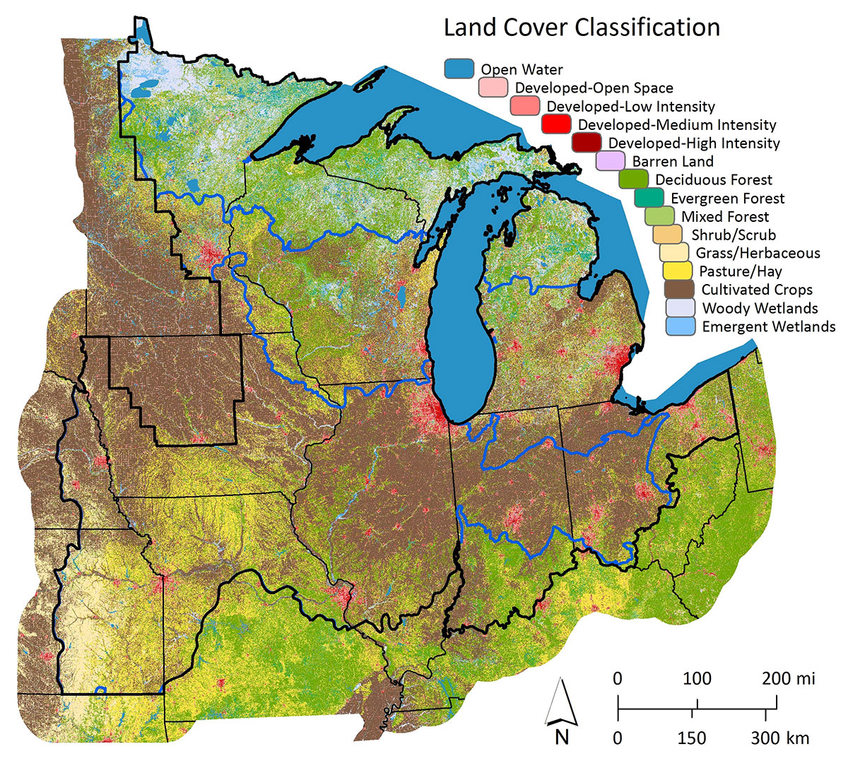
Land Cover Classification
Landscape composition of the Upper Mississippi / Great Lakes Joint Venture Region (2011 National Land Cover Data; BCR boundaries within the JV region in blue).
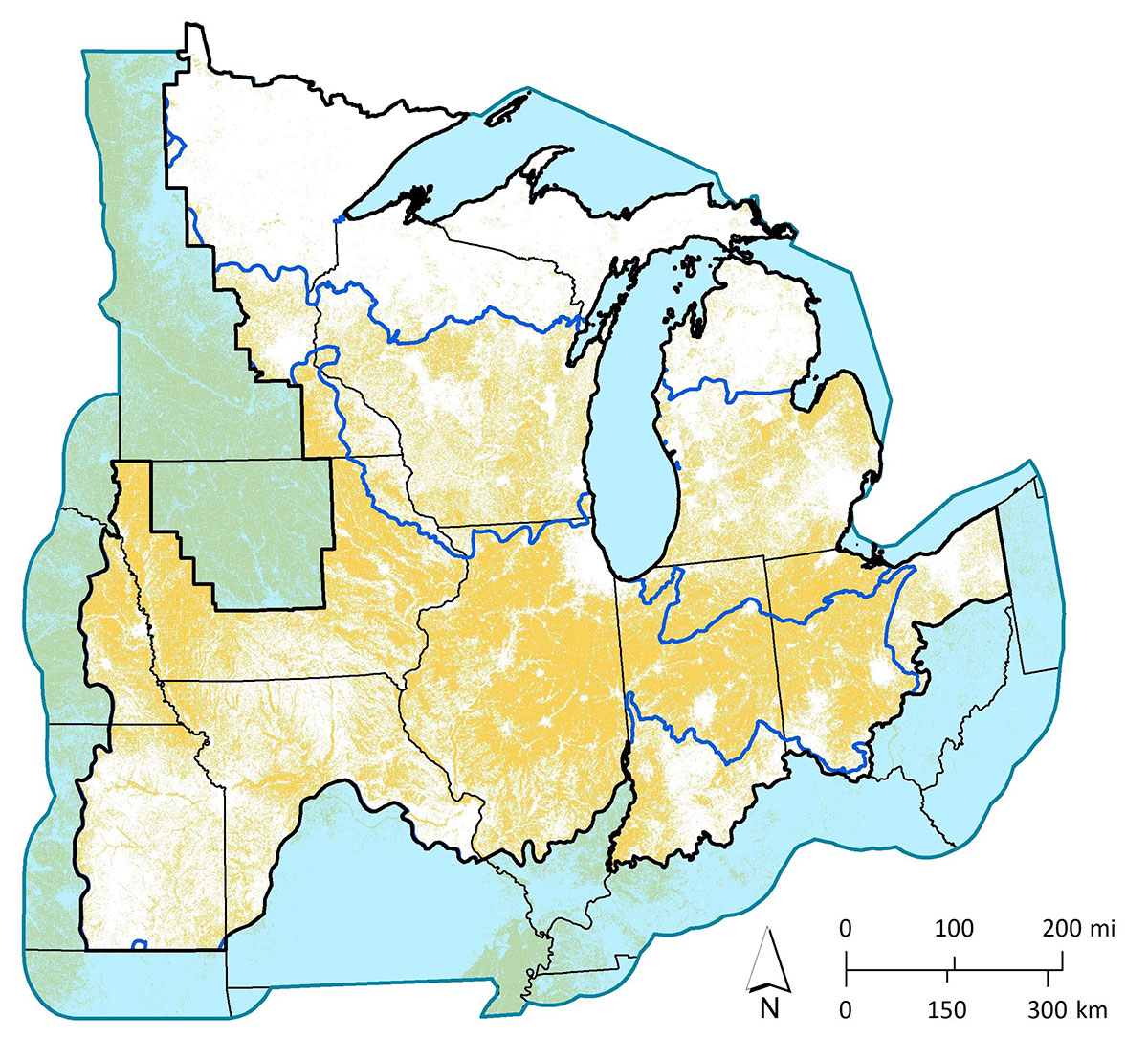
Cultivated Cropland
Cultivated Cropland in the Upper Mississippi / Great Lakes Joint Venture Region (2011 National Land Cover Data; BCR boundaries within the JV region in blue).
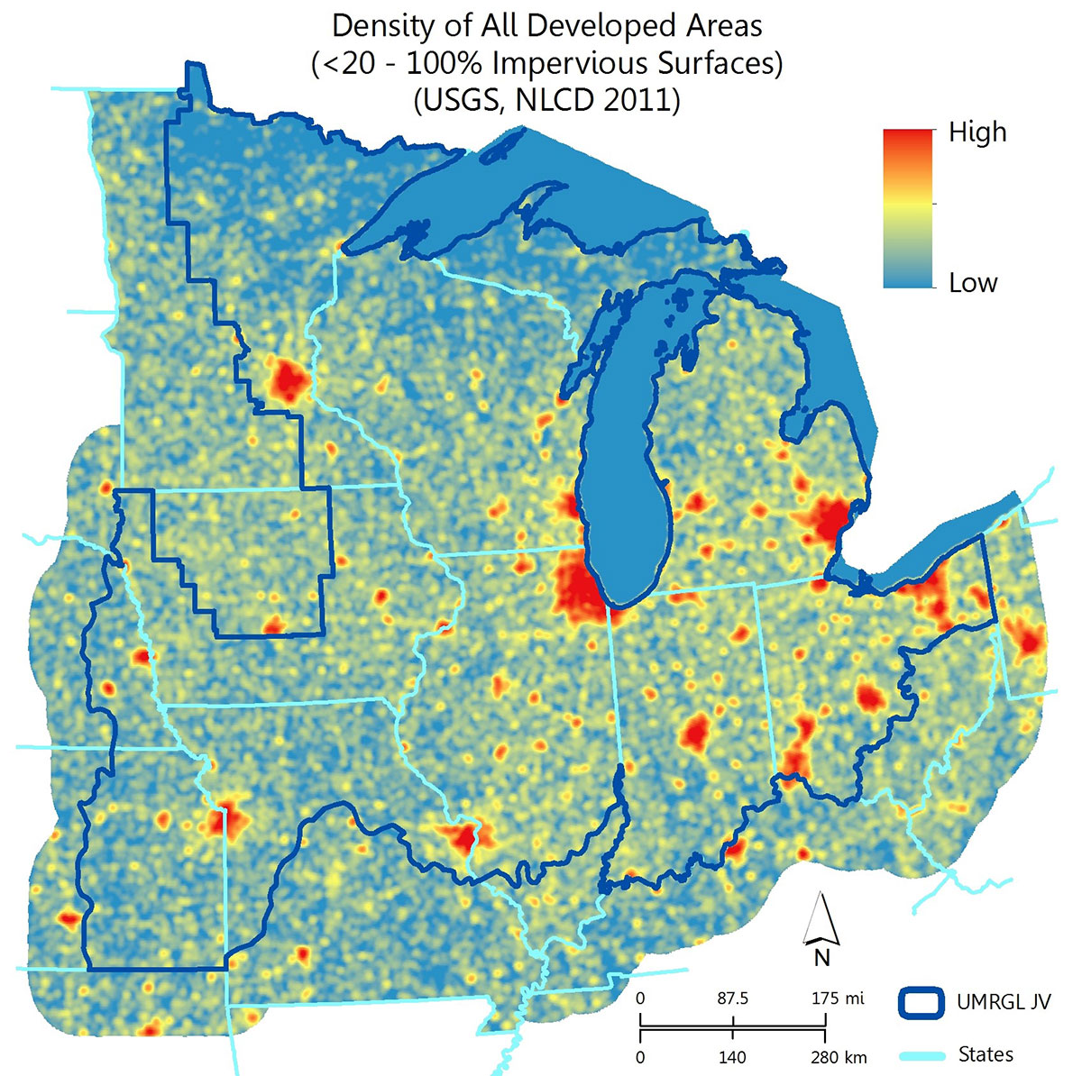
Density of All Developed Areas
Density and distribution of all developed areas in the Upper Mississippi / Great Lakes Joint Venture Region (2011 National Land Cover Data; JV boundaries in blue).
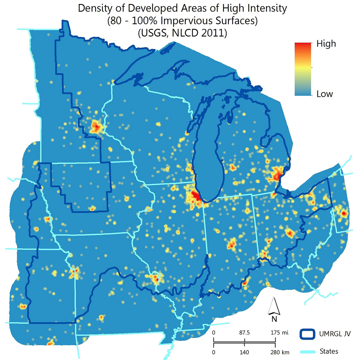
Density of Developed Areas of High Intensity
Density and distribution of developed areas of high intensity in the Upper Mississippi / Great Lakes Joint Venture Region (2011 National Land Cover Data; JV boundaries in blue).
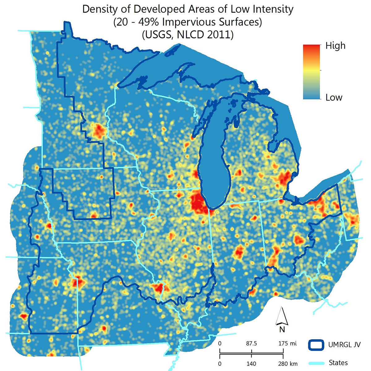
Density of Developed Areas of Low Intensity
Density and distribution of developed areas of low intensity in the Upper Mississippi / Great Lakes Joint Venture Region (2011 National Land Cover Data; JV boundaries in blue).
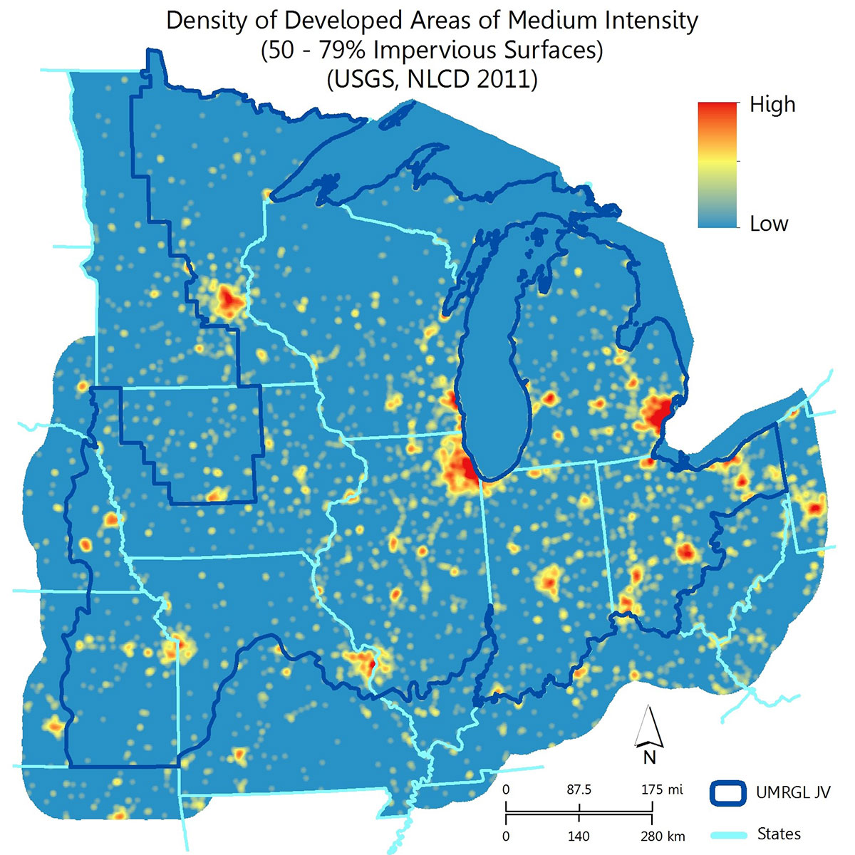
Density of Developed Areas of Medium Intensity
Density and distribution of developed areas of medium intensity in the Upper Mississippi / Great Lakes Joint Venture Region (2011 National Land Cover Data; JV boundaries in blue).
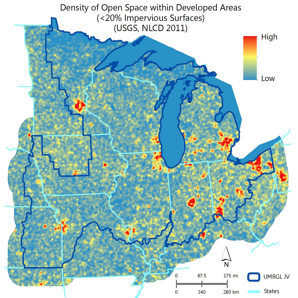
Density of Open Space with Developed Areas
Density and distribution of open space within developed areas in the Upper Mississippi / Great Lakes Joint Venture Region (2011 National Land Cover Data; JV boundaries in blue).


