GIS Datasets – Bird Conservation Regions
Bird Conservation Regions (BCRs)
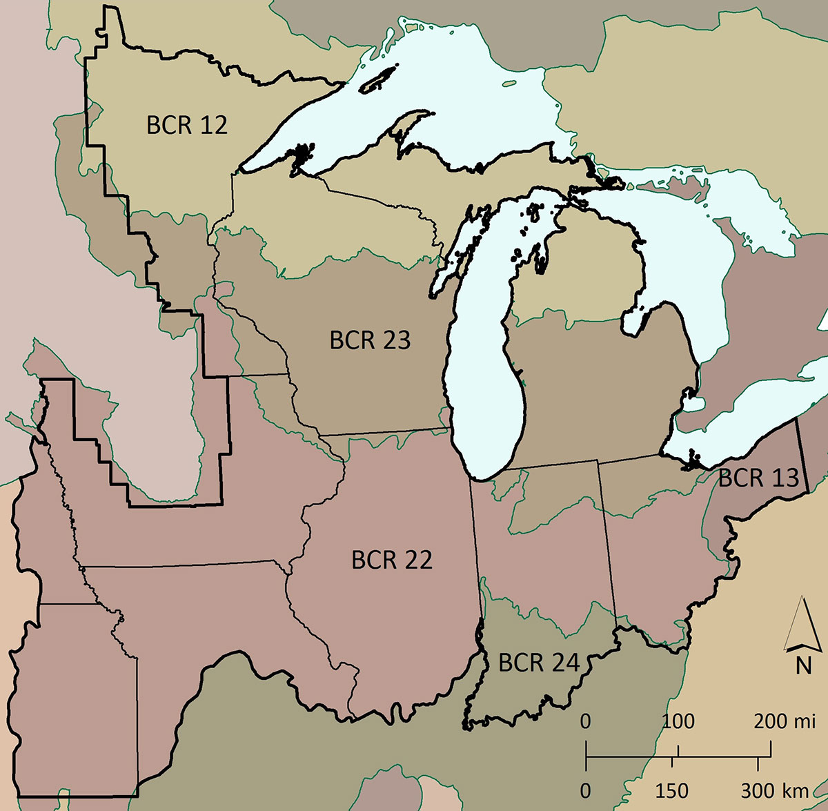
BCRs are geographic designations that have similar land-cover types, bird communities, and resource conservation issues. They are the fundamental biological units through which the NABCI promotes delivery of landscape-scale bird conservation. BCRs provide a consistent spatial framework for evaluation, planning, and in some instances implementation. By employing broad units that are ecologically meaningful to bird populations, conservation efforts can be tailored to support groups of species throughout their range. Land-cover composition, combined with soil characteristics, water chemistry, and wetland hydrology result in functional differences among BCRs that influence distribution and abundance of wetland birds. Understanding these functional differences and trends in key cover types across the JV region is important to making effective conservation decisions.
Boundaries of the Upper Mississippi River and Great Lakes Joint Venture region (black line) and associated Bird Conservation Regions (BCRs, color discerned).
Boreal Hardwood Transition (BCR 12)
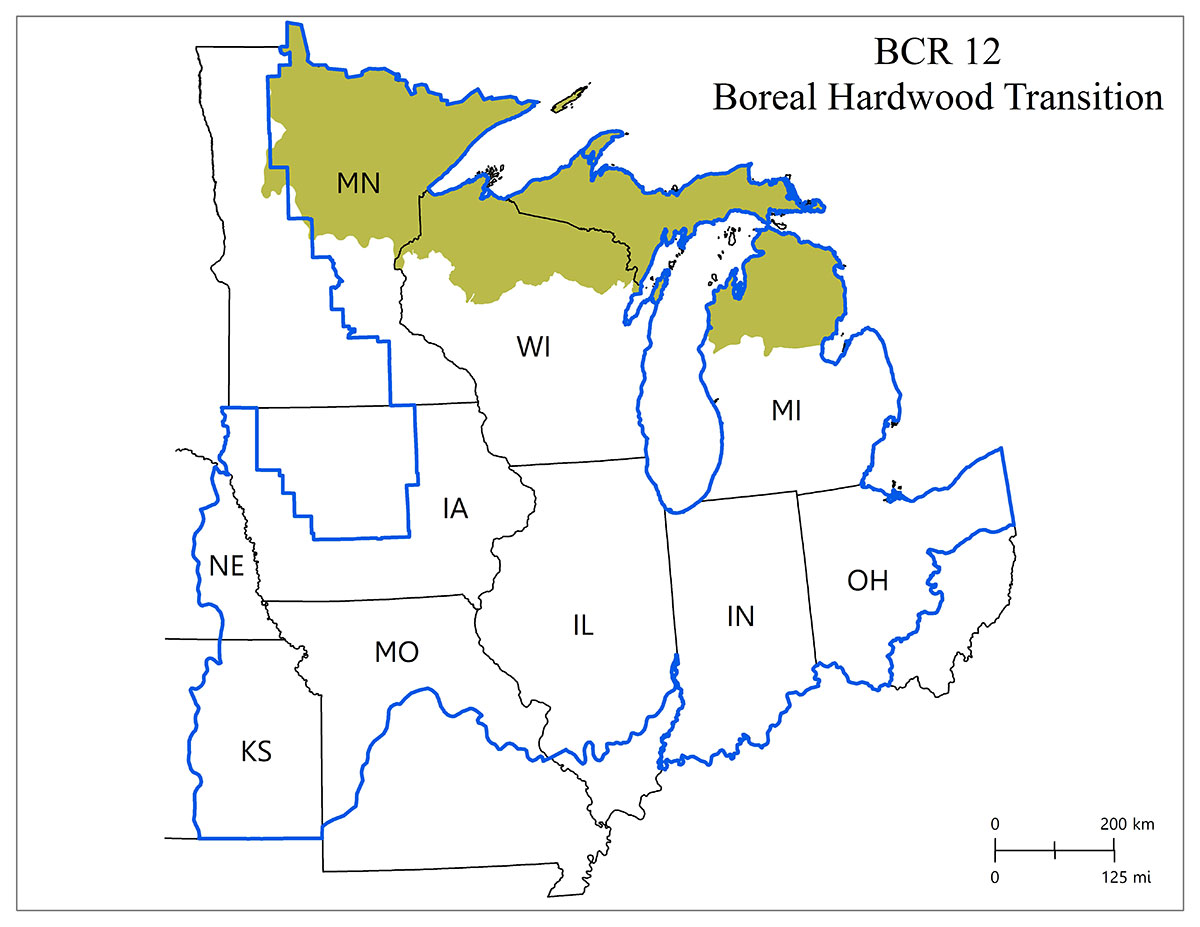
Boreal Hardwood Transition (BCR 12). The northern-most area of the JV region can be characterized by coniferous (evergreen) and deciduous forests, nutrient-poor soils, and an extraordinary abundance of lakes, wetlands, and river systems.
Lower Great Lakes/St. Lawrence Plain (BCR 13).
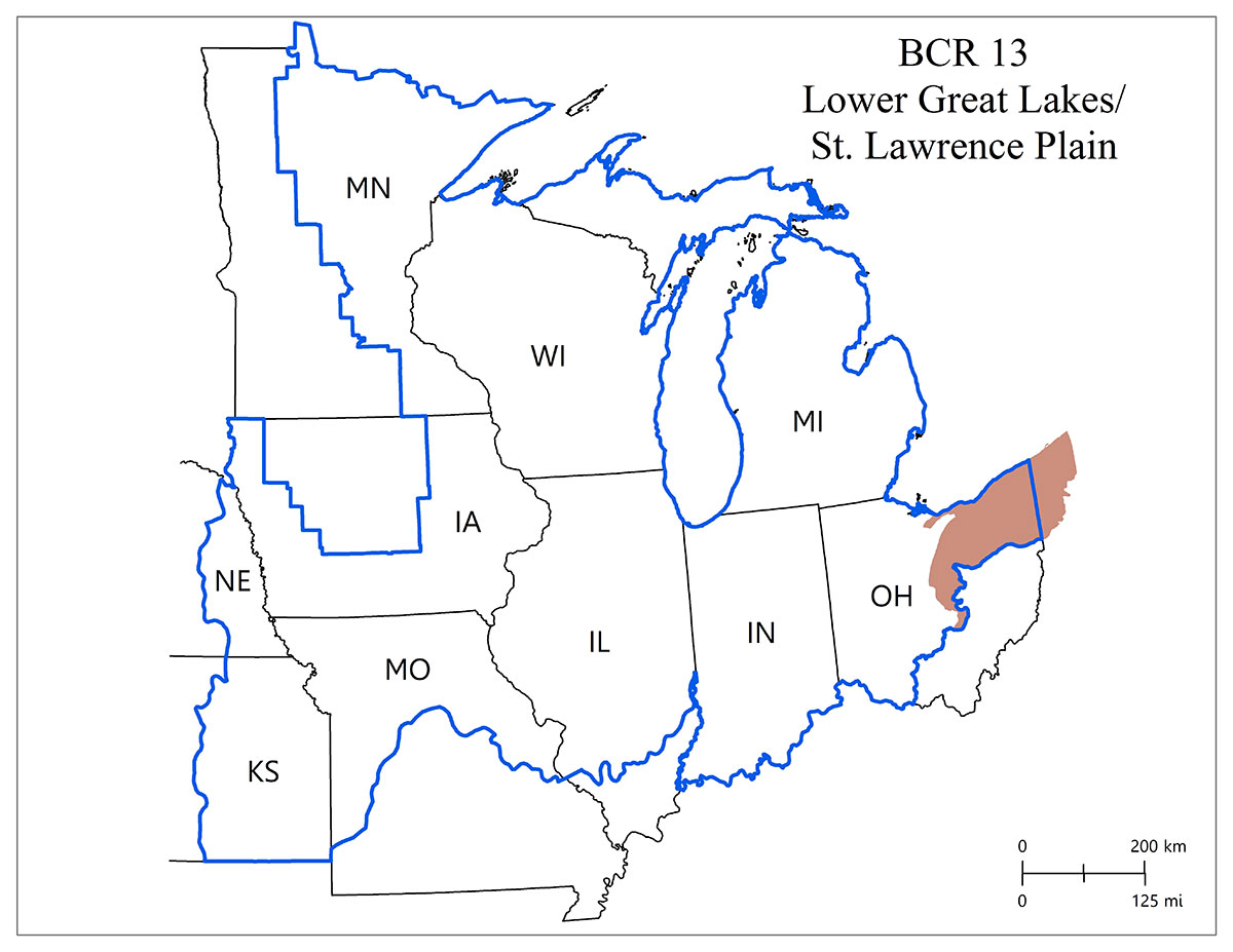
The area of BCR 13 within the JV region is also relatively small (northeast Ohio). It was originally dominated by deciduous and mixed-coniferous forests. Now only 31% of the area is classified as upland forest and another 3% is forested wetland.
Eastern Tallgrass Prairie (BCR 22)
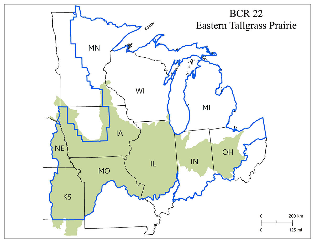
Covering the southern half of the JV region, this BCR is almost entirely within the JV boundary. It once contained the most extensive tall-grass prairie of the Great Plains, growing on the most nutrient-rich soils in North America.
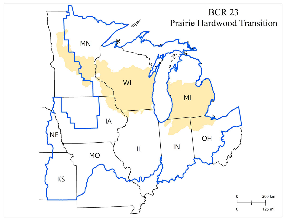
Prairie Hardwood Transition (BCR 23)
Prairie, hardwood forest, and savanna once dominated this area, but cropland and developed land have replaced much of the natural land cover, especially grasslands and seasonal and temporary wetlands.
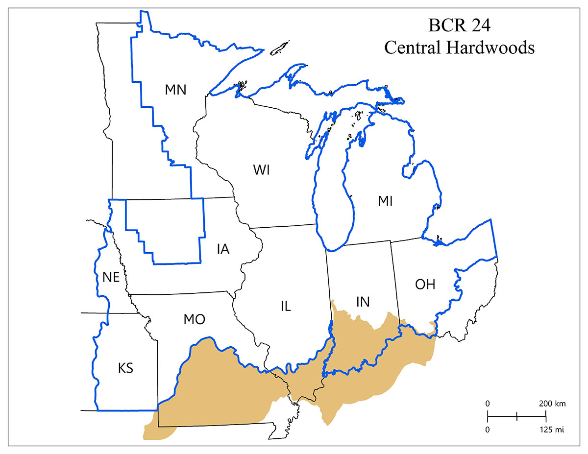
Central Hardwoods (BCR 24)
Only a small area of BCR 24 (southern Indiana) overlaps the JV region. Once dominated by deciduous forest, BCR 24 now includes a mix of agricultural lands and forests, with minor coverages of open water (4%) and herbaceous wetland (0.5%).


