Partner Plans, Step-down Plans, & Tools
The Joint Venture includes conservation partners across the 10-state region who have developed habitat objectives for birds at regional scale. To make bird-habitat implementation more applicable to their respective agencies and organizations, some partners have stepped down the JV regional plans to smaller jurisdictions and or refined how they target regional conservation objectives based on their stakeholder priorities.
Ohio All-Bird Conservation Plan
The Second Ohio All-bird Conservation Plan (2022) is a collaborative effort among individuals representing numerous organizations that serve on the OBCI’s Conservation Planning and Research Committee. This plan has two main functions: to identify ways to “stepdown” regional conservation plans to the state level, and to provide guidance for bird conservation efforts in Ohio.
The Second Ohio All-bird Conservation Plan (2022) integrates data and recommendations from conservation plans developed by national bird conservation initiatives, the regional migratory bird joint ventures, and the Ohio Department of Natural Resources. We identified focal bird species (i.e., those prioritized for conservation efforts) by using conservation decision support tools from Partners in Flight and priority species from regional joint venture lists (UMGL JV and AMJV). Focal species may also include species for which Ohio has high conservation responsibility, species that use unique habitats within the state, and species of greatest conservation need as identified in the Ohio Division of Wildlife’s State Wildlife Action Plan (SWAP, ODW 2015).

Breeding Duck Habitat Assessment for Northern Ohio
This assessment, completed for the Ohio Waterfowl Production Area Study Team (U.S. Fish and Wildlife Service and Ohio Dept. of Natural Resources), was developed to inform decisions regarding waterfowl breeding habitat establishment in northern Ohio. The primary goal for designated waterfowl production areas (WPAs) is to provide duck habitat with relatively high survival and recruitment during the breeding period. However, these wetland / upland plant communities (habitat complexes) actually offer myriad benefits to wildlife and to people, and integrating biological and social objectives into habitat conservation decisions is promoted in the North American Waterfowl Management Plan (NAWMP 2012 and 2018).
Wisconsin Waterfowl Habitat Conservation Strategy
This document was developed collaboratively by Wisconsin partners with support from the UMGL JV Science Staff to guide and inform decisions for waterfowl habitat conservation. Conceived as a step-down from the 2017 JV Waterfowl Habitat Conservation Strategy, the Wisconsin strategy integrates technological advances, trends in landscape cover types, and changing attitudes of society since the original Wisconsin Plan was produced nearly 30 years ago. Some key components in this strategy include: specific waterfowl habitat objectives for the next 15 years, summaries of landscape change and of waterfowl population changes since 1992, a habitat delivery decision support tool, and priorities for future research, monitoring, and planning refinement.

Upper Mississippi Valley/Great Lakes Regional Shorebird Conservation Plan (Version 2.0)
The Upper Mississippi Valley / Great Lakes (UMVGL) region is a diverse area that includes five Bird Conservation Regions (BCRs) and provides important habitat for shorebirds, especially migrants. In 2000, Version 1.0 of the UMVGL Regional Shorebird Conservation Plan (de Szalay et al. 2000) was developed. This plan – Version 2.0 – updates that document. Thirty-five shorebird species occur regularly in the UMVGL region, and information is provided on their seasonal occurrence and abundance in each of the BCRs comprising the UMVGL region. Habitat preferences, migration chronology, population status, and management recommendations are also noted. Updated information on continental populations has been stepped down to the UMVGL region. A primary goal of this plan is to guide action that will ensure the availability of shorebird foraging and nesting sites over a range of climatic conditions by protecting, restoring, and managing a variety of habitat types throughout the UMVGL region.
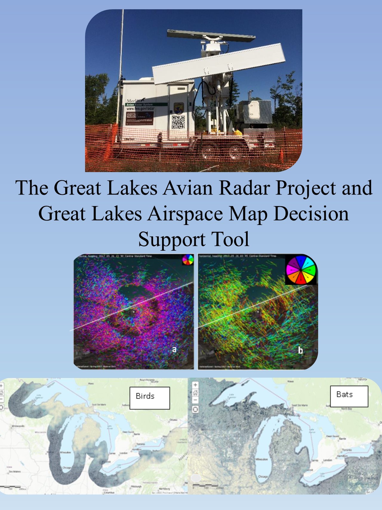
The Great Lakes Airspace Map – a Decision Support Tool
Mapping migratory bird and bat concentration areas throughout the Great Lakes basin
The Great Lakes basin is known to be important to both birds and bats, but little was known quantitatively about basin-wide concentration areas that could inform conservation priorities. The U.S. Fish and Wildlife Service’s (Service) Avian Radar Project was initiated specifically to more fully describe spring and fall migrations and identify areas important to nocturnally migrating birds and migratory and non-migratory bats.
Find more information at the Avian Radar website. You can find a link to the Great Lakes Airspace Map DST and a user’s guide on the website, along with project reports and data.
Check out the The Great Lakes Airspace Map – a Decision Support Tool Story Map.