GIS Datasets
The JV Science Office maintains and distributes regional bird habitat spatial data to conservation partners. Images, maps, and associated GIS files found in the Joint Venture Habitat Conservation Strategies and 2007 Implementation Plan are available upon request. The Science Office can also provide information for other regional conservation initiatives (e.g., Great Lakes American Woodcock and Young Forest Initiative). Examples of data available are listed below; not all available data is listed.
Please send requests for GIS files or custom images to Mohammed_Al-Saffar@fws.gov.
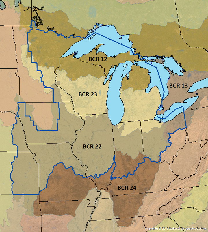
Bird Conservation Regions and JV boundary
BCRs are geographic designations that have similar land-cover types, bird communities, and resource conservation issues. They are the fundamental biological units through which the NABCI promotes delivery of landscape-scale bird conservation. BCRs provide a consistent spatial framework for evaluation, planning, and in some instances implementation. By employing broad units that are ecologically meaningful to bird populations, conservation efforts can be tailored to support groups of species throughout their range. Land-cover composition, combined with soil characteristics, water chemistry, and wetland hydrology result in functional differences among BCRs that influence distribution and abundance of wetland birds. Understanding these functional differences and trends in key cover types across the JV region is important to making effective conservation decisions.
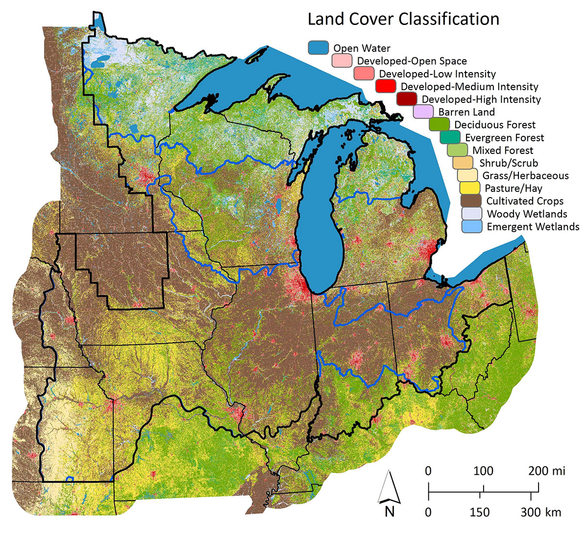
Land Cover
Landscape cover types within the JV region vary from heavily forested in the north and east to agriculture-dominated in the south and west. Thousands of glacial lakes, herbaceous and forested wetlands, and beaver ponds in the north part of the region transition into an environment with fewer natural basins and primarily river floodplain wetlands in the south. Wetland conditions change from generally oligotrophic in the far north to mesotrophic and eutrophic in the central and south portions of the region. Vegetation communities more closely resemble historic conditions in the north, whereas human-induced landscape changes have disrupted physical (i.e., hydrology) and ecological (i.e., plant succession) processes in much of the south.
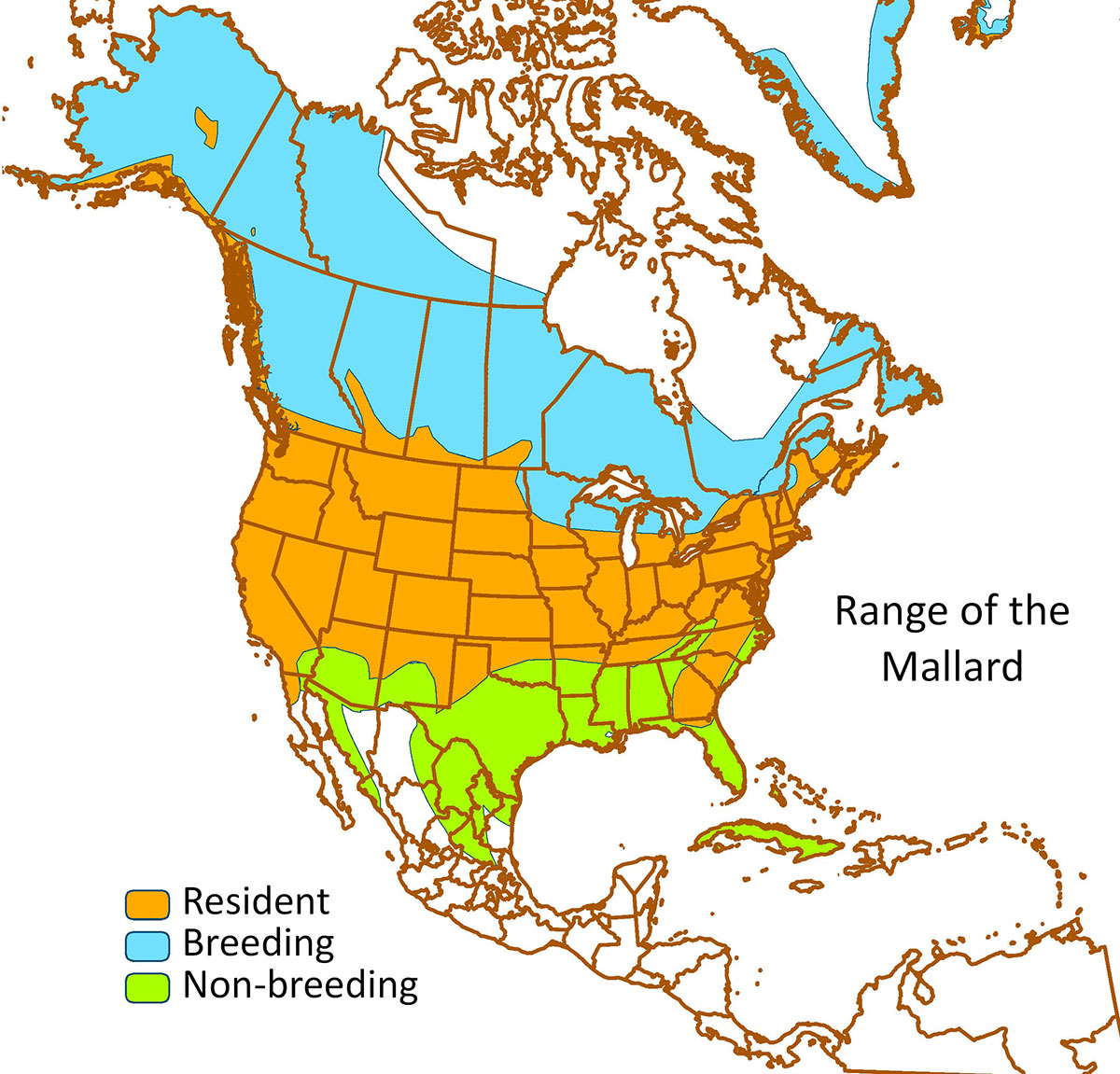
Bird Ranges
Bird range maps data source is BirdLife International and Cornell Lab of Ornithology (2016). Maps were re-produced by the UM/GL JV staff for JV’s focal species in the latest revisions of the waterfowl and waterbird strategic plans (2017 and 2018 respectively).
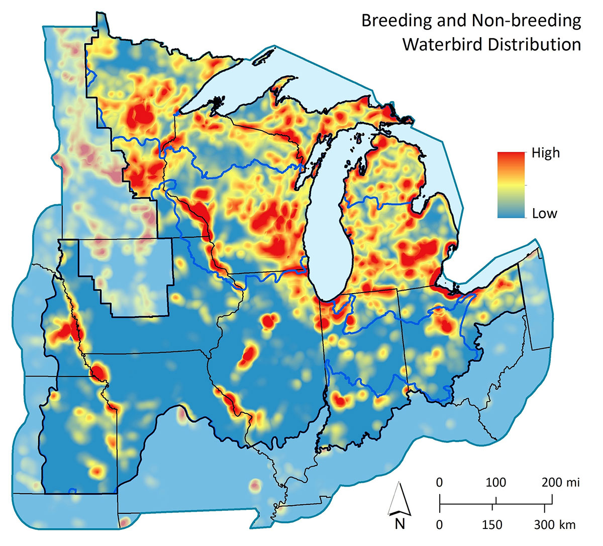
Waterbird
Datasets for density and distribution of important breeding and non-breeding habitats for waterbirds in the Upper Mississippi / Great Lakes Joint Venture (JV) region.
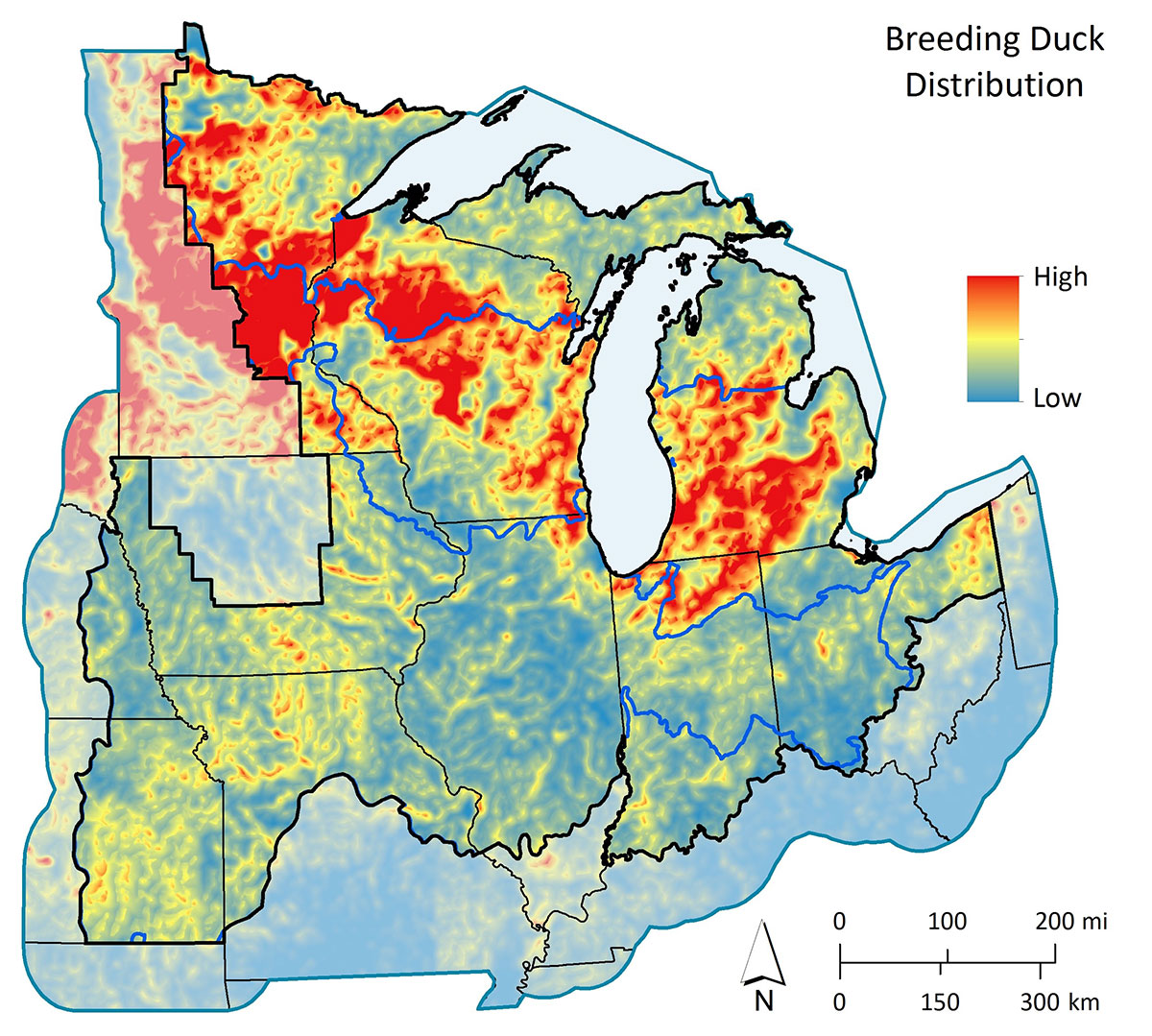
Waterfowl
Datasets for density and distribution of important breeding and non-breeding habitats for waterfowl in the Upper Mississippi / Great Lakes Joint Venture (JV) region.
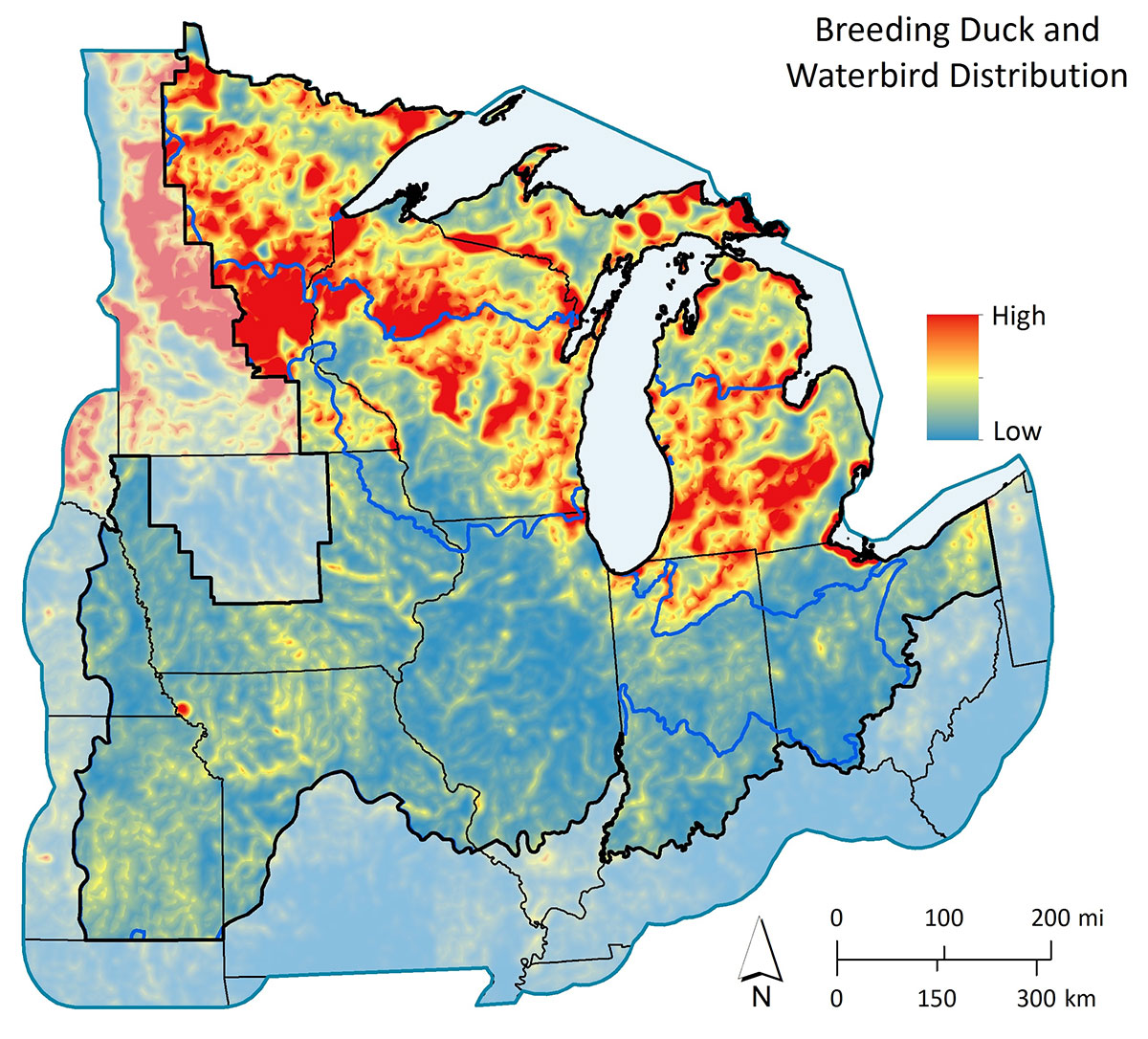
Waterbird & Waterfowl
Datasets for density and distribution of important breeding and non-breeding habitats for waterbirds and waterfowl in the Upper Mississippi / Great Lakes Joint Venture (JV) region.
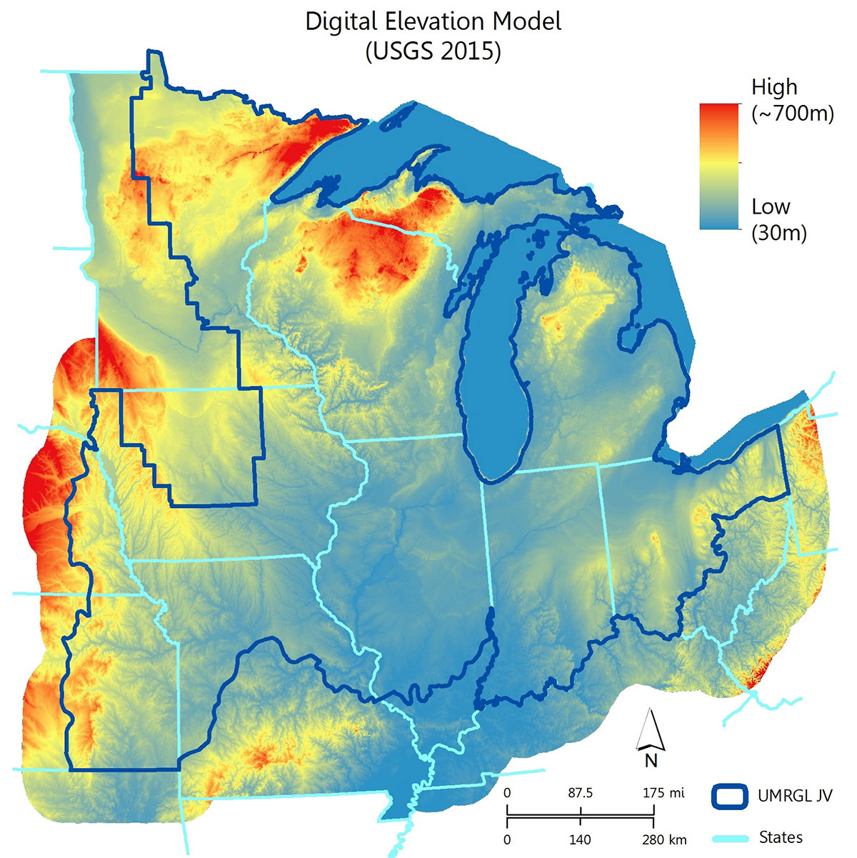
Supplemental
Supplemental GIS Datasets for the Upper Mississippi / Great Lakes Joint Venture (JV) region.


