GIS Datasets – Bird Ranges
Bird range maps data source is BirdLife International and Cornell Lab of Ornithology (2016). Maps were re-produced by the UM/GL JV staff for JV’s focal species in the latest revisions of the waterfowl and waterbird strategic plans (2017 and 2018 respectively).
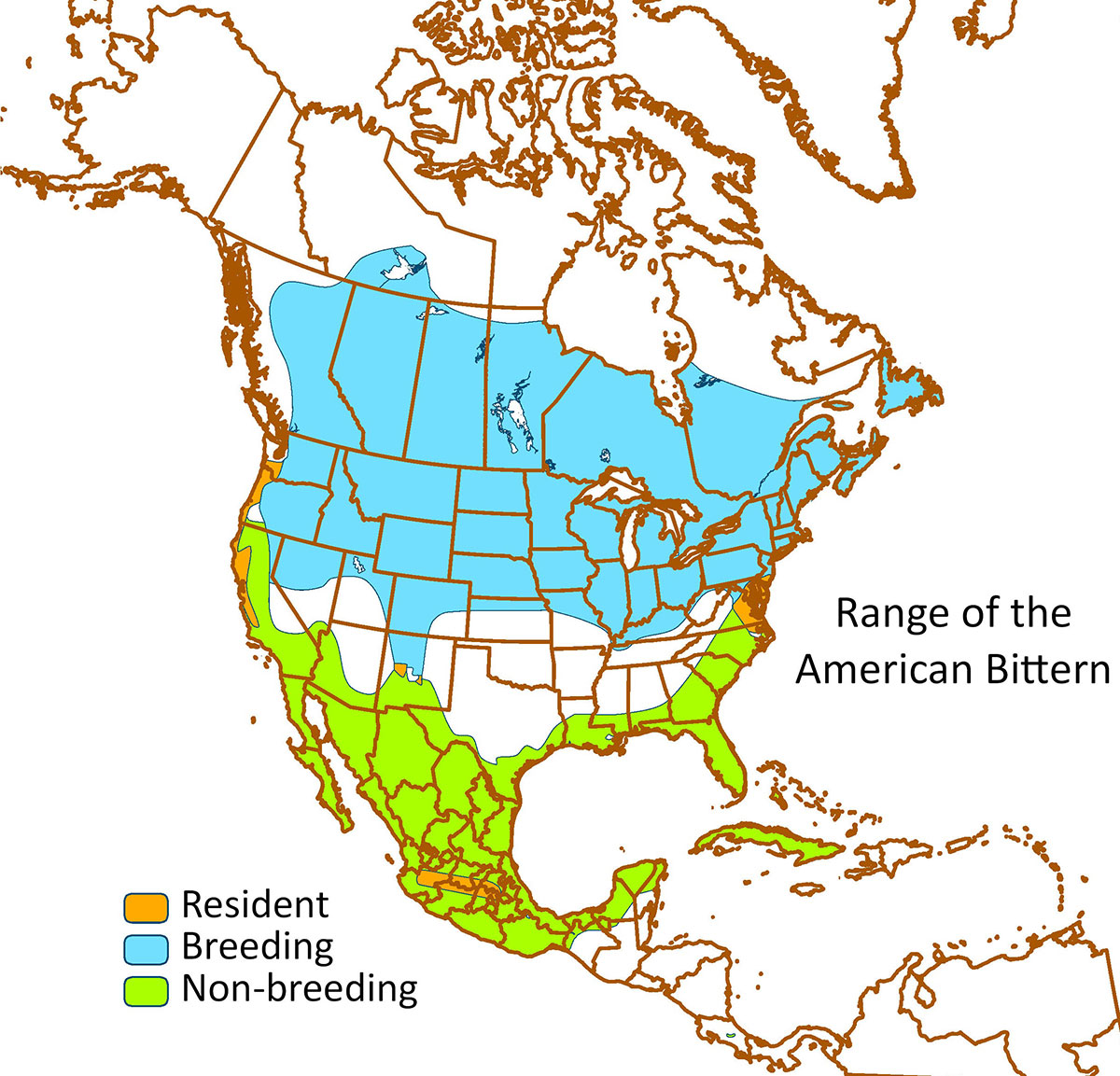
American Bittern
Range of the American Bittern. Data source: BirdLife International and Cornell Lab of Ornithology (2016).
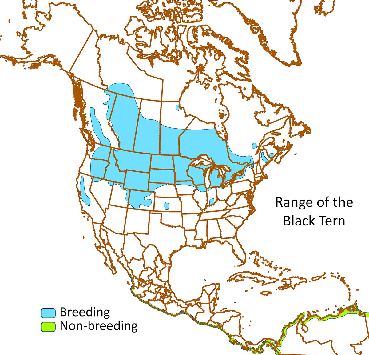
Black Tern
Range of the Black Tern. Data source: BirdLife International and Cornell Lab of Ornithology (2016).
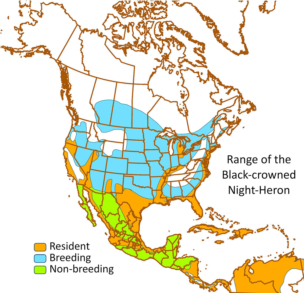
Black-crowned Night-Heron
Range of the Black-crowned Night-Heron. Data source: BirdLife International and Cornell Lab of Ornithology (2016).

Blue-winged Teal
Range of the Blue-winged Teal. Data source: BirdLife International and Cornell Lab of Ornithology (2016).
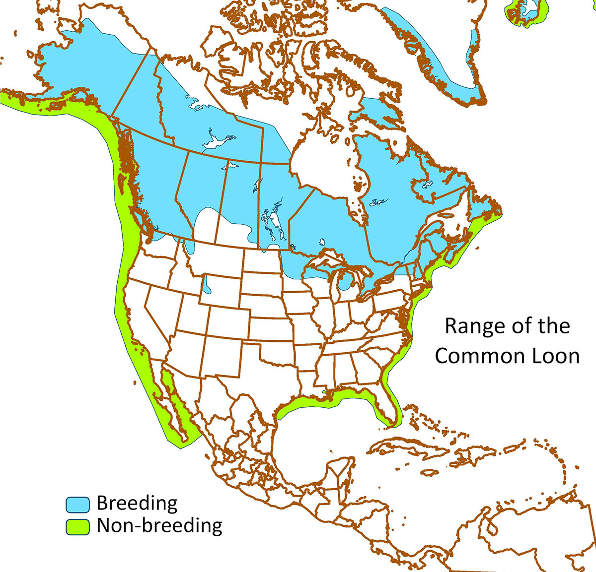
Common Loon
Range of the Common Loon. Data source: BirdLife International and Cornell Lab of Ornithology (2016).
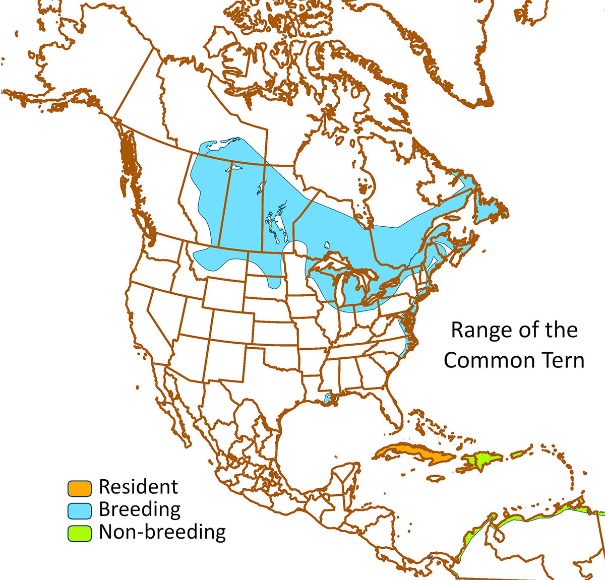
Common Tern
Range of the Common Tern. Data source: BirdLife International and Cornell Lab of Ornithology (2016).
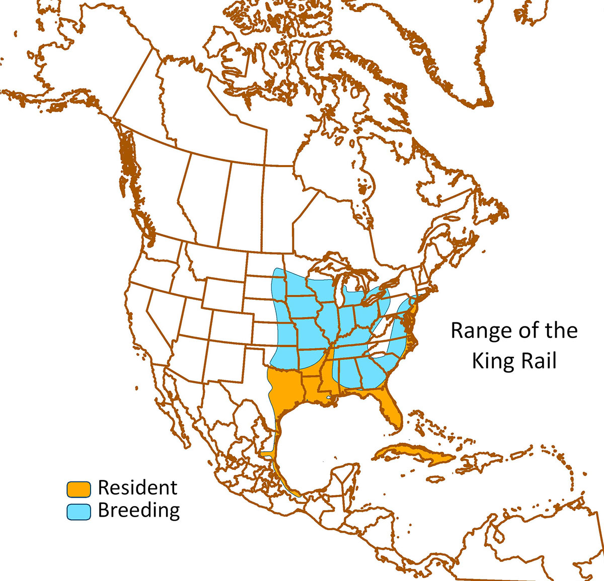
King Rail
Range of the King Rail. Data source: BirdLife International and Cornell Lab of Ornithology (2016).
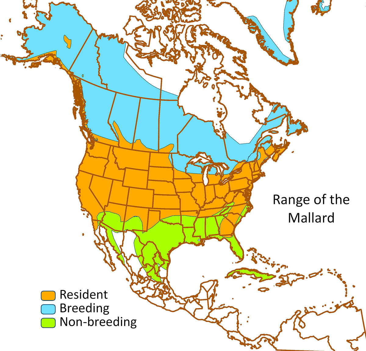
Mallard
Range of the Mallard. Data source: BirdLife International and Cornell Lab of Ornithology (2016).
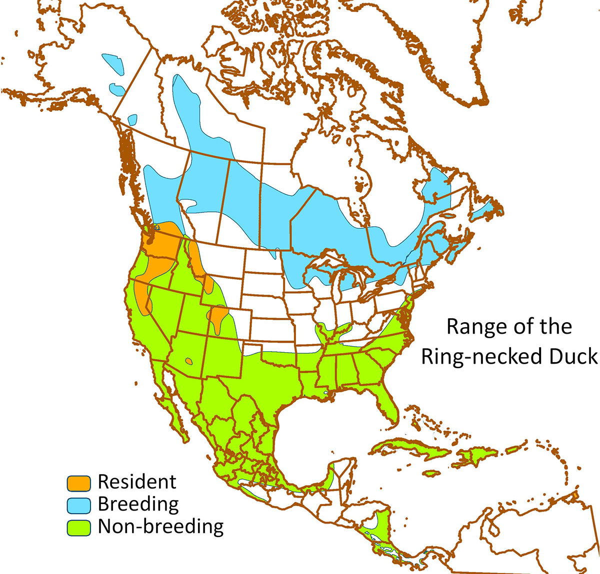
Ring-necked Duck
Range of the Ring-necked Duck. Data source: BirdLife International and Cornell Lab of Ornithology (2016).
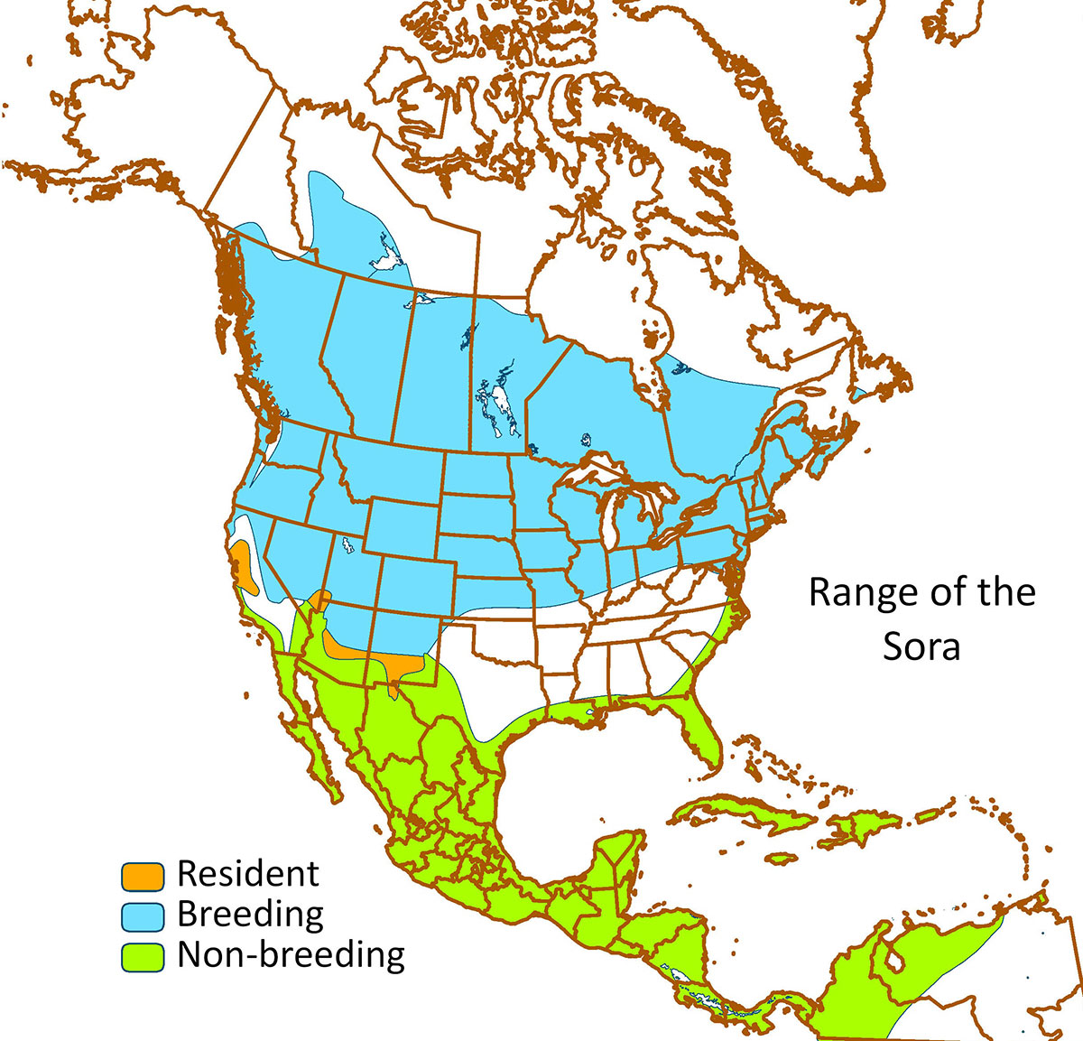
Sora
Range of the Sora. Data source: BirdLife International and Cornell Lab of Ornithology (2016).
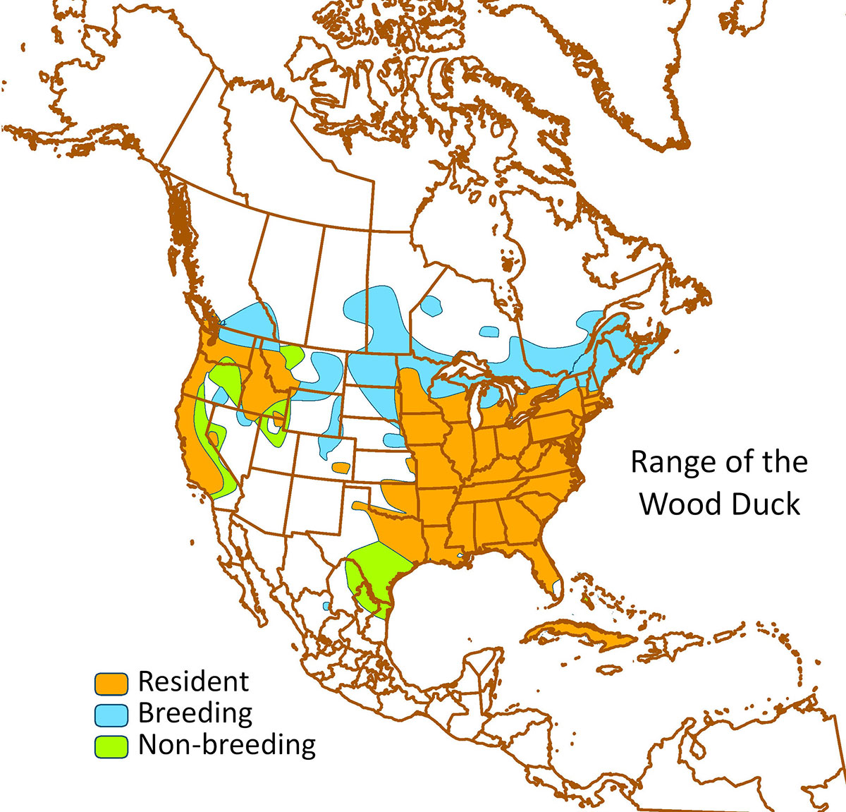
Wood Duck
Range of the Wood Duck. Data source: BirdLife International and Cornell Lab of Ornithology (2016).
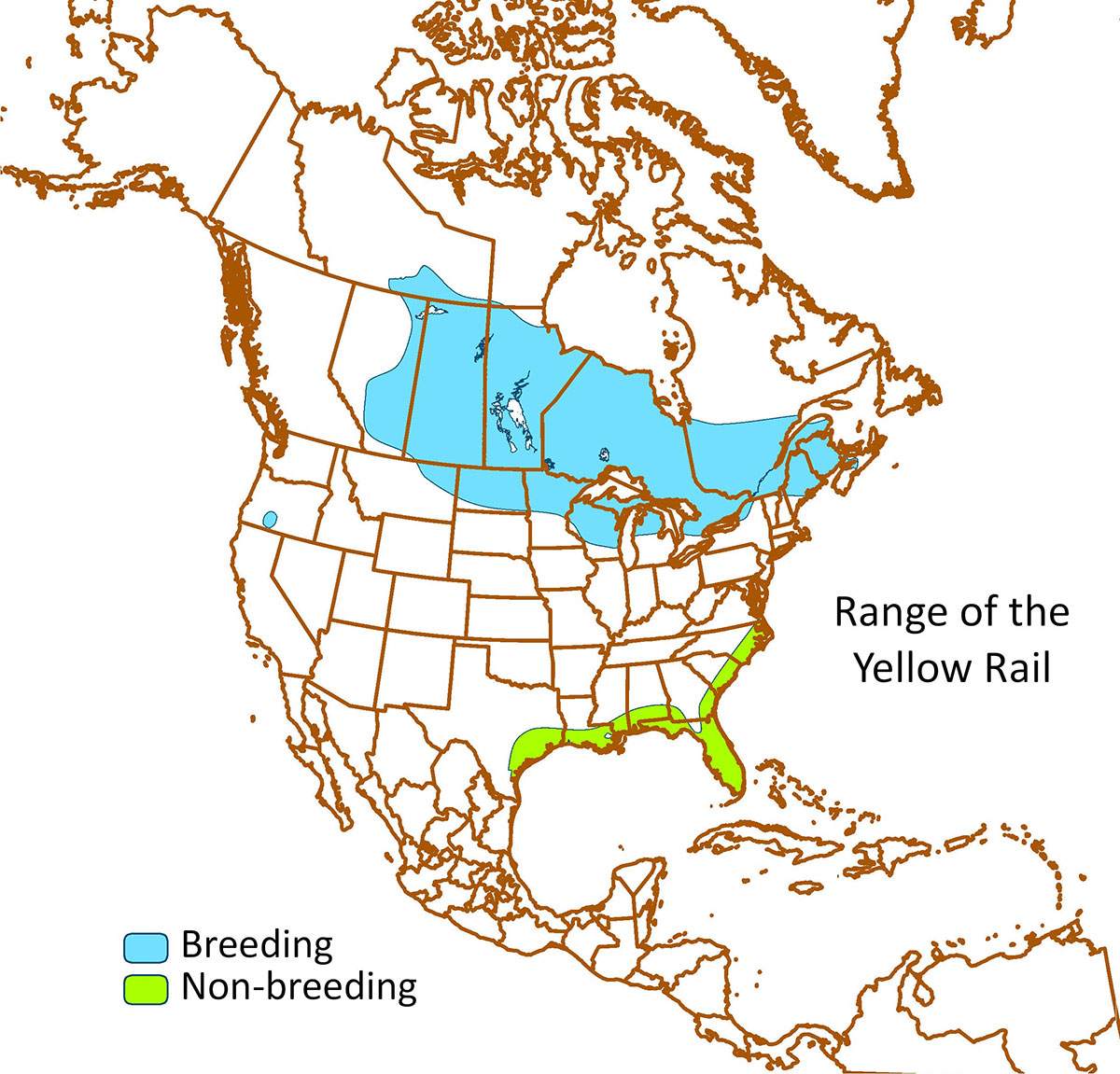
Yellow Rail
Range of the Yellow Rail. Data source: BirdLife International and Cornell Lab of Ornithology (2016).


