The US Fish and Wildlife Service Avian Radar Project is excited to share their new website and Story Map that showcases their Great Lakes Airspace Map Decision Support Tool!
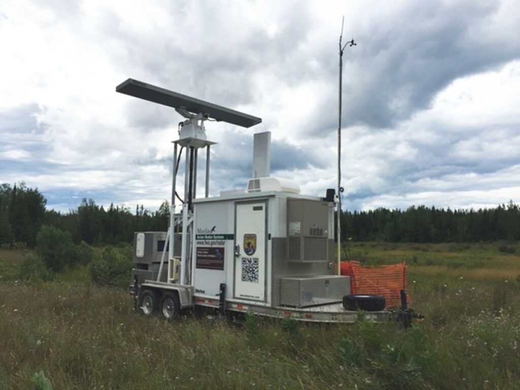
An avian radar unit with scanners to record nighttime migration and an acoustic monitor to record bat calls.
The Great Lakes basin is known to be important to both birds and bats, but little was known quantitatively about basin-wide concentration areas that could inform conservation priorities. The U.S. Fish and Wildlife Service’s (Service) Avian Radar Project was initiated specifically to more fully describe spring and fall migrations and identify areas important to nocturnally migrating birds and migratory and non-migratory bats.
Find more information at the Avian Radar website. You can find a link to the Great Lakes Airspace Map DST and a user’s guide on the website, along with project reports and data. Check out the The Great Lakes Airspace Map – a Decision Support Tool Story Map.
We will also have links to these amazing resources on our Partner Plans, Step-down Plans, & Tools webpage.
Trackplots of migratory birds flying north-northwest during spring migration, May 26, 2017, Indiana Dunes, Indiana. Each line represents an individual migrant.
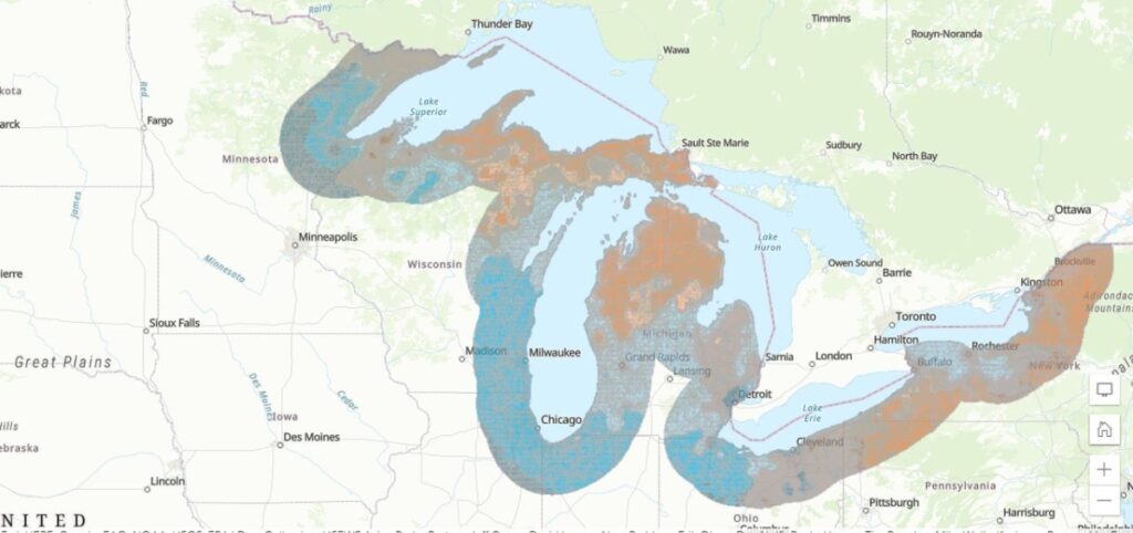
Consistently high concentration of migrants throughout the spring migration season shown in blue, along the western edge of the Great Lakes basin. Warmer colors at the center and eastern edge of the basin indicate lower migrant concentrations and greater variation in the number of migrants passing through each night throughout the season.